

A flock of painted stork, whose population has increased.
A quarter century of ornithological observations of wetland birds of Kerala come with a mixed bag of joy and despair for birders.
At a time when the wetlands of the State are facing multi-pronged threats, the population of a few bird species has been found soaring whereas some others have nose-dived in the population chart. Researchers focused their attention on the data generated from the four Ramsar sites of the State – Sasthamkotta Lake, Ashtamudi Lake, Vembanad Lake and Kole Wetlands – and also the other important wetland habitats to get a bird’s eye view of the population trends of wetland avian fauna.
The brightly coloured purple swamphen is one species that have thrived amidst widespread destruction of its habitats. Its population trend analysis demonstrated that the species has increased in Kerala during the last decade.
Ornithologists arrived at the conclusion after evaluating the bird data picked up from the Asian Water bird Census (AWC) held between 1987 and 2014. The annual census, coordinated by Wetlands International, also happens to be the first country-wide citizen science activity on natural history in India. An influx of Eurasian coot, which was an added to the list of Kerala birds during the late 1980s, has been reported in the State during winter season.
The painted stork, earlier evaluated as a vagrant visitor to wetlands of Malabar and south Kerala has spread beyond the region they are generally found predicted ornithologists, after taking into account the reports of its sightings in other parts of the State.
The population of Asian Openbill, extremely rare during the 1970s, has remarkably increased since 2001, with at least four census reporting the presence of more than 3,000 birds. So is the case of Eurasian spoonbill as there have been several reports of sighting of large flocks from Kole Wetlands, Vembanad Lake and Kuttanad Wetlands. Same is the case with blackheaded Ibis.
Indian spotbilled duck, glossy ibis, oriental darter, Asian woollyneck and spotbilled pelican recorded increased presence whereas the population of the river terns and cormorants remained stable.
But the bird group of terns underwent a steady decline over the years. From the nearly 30,000-strong population in 1993-94, it had plummeted to just near 10,000 in the last decade. The loss of estuarine habitat like Purathur in Malappuram district and disturbances in other estuaries might have contributed to this decline. The decline was evident in the relatively stable sites such as Kole Wetlands, rued the ornithologists.
The population of whiskered tern, which form the major chunk of the population of the terns in the State, too has fallen significantly. Gulls too painted a gloomy picture as they were sighted in lesser number during the past few censuses. The BirdLife International has recorded that 11 water bird species of Kerala come under the IUCN Red list threatened categories with the black bellied tern being one of the ‘Endangered’ waterbird species in Kerala.
The only report of black bellied tern during AWC was from the Kole Wetlands; great knot, a ‘vulnerable,’ trans-continental migrant, has been reported from four sites whereas the Asian woolly neck stork (another vulnerable species), has been reported from 44 wetlands across the State.
Threats identified
Demographic pressure, industrial development, pollution, urbanisation, agriculture and aquaculture and water transport have been adding pressure on the wetlands of the State.
Reclamation of wetlands and the aquatic ecosystems, which are often considered as wastelands, is spelling trouble to several taxa. The stake nets used for fishing removes a wide array of non-target organisms, which are functionally important to the aquatic environment. Destructive fishing practise are also taking a toll on the bird population, it was reported.
Unregulated fishing, reclamation of wetlands, dumping of solid waste and domestic sewage too posed threats to the wetlands of Kerala, according to ornithologists.
Ramsar Convention:-
The Convention on Wetlands of International Importance, called the Ramsar Convention, is the intergovernmental treaty that provides the framework for the conservation and wise use of wetlands and their resources.
The Convention was adopted in the Iranian city of Ramsar in 1971 and came into force in 1975. Since then, almost 90% of UN member states, from all the world’s geographic regions, have acceded to become “Contracting Parties”.

The Convention’s mission is “the conservation and wise use of all wetlands through local and national actions and international cooperation, as a contribution towards achieving sustainable development throughout the world”.
Wetlands are among the most diverse and productive ecosystems. They provide essential services and supply all our fresh water. However they continue to be degraded and converted to other uses.
The Convention uses a broad definition of wetlands. It includes all lakes and rivers, underground aquifers, swamps and marshes, wet grasslands, peatlands, oases, estuaries, deltas and tidal flats, mangroves and other coastal areas, coral reefs, and all human-made sites such as fish ponds, rice paddies, reservoirs and salt pans.
Under the “three pillars” of the Convention, the Contracting Parties commit to:
- work towards the wise use of all their wetlands;
- designate suitable wetlands for the list of Wetlands of International Importance (the “Ramsar List”) and ensure their effective management;
- cooperate internationally on transboundary wetlands, shared wetland systems and shared species.
The importance of wetlands
Wetlands are vital for human survival. They are among the world’s most productive environments; cradles of biological diversity that provide the water and productivity upon which countless species of plants and animals depend for survival.
Wetlands are indispensable for the countless benefits or “ecosystem services” that they provide humanity, ranging from freshwater supply, food and building materials, and biodiversity, to flood control, groundwater recharge, and climate change mitigation.
Yet study after study demonstrates that wetland area and quality continue to decline in most regions of the world. As a result, the ecosystem services that wetlands provide to people are compromised.
Managing wetlands is a global challenge and the Convention presently counts over 160 countries as Contracting Parties, which recognize the value of having one international treaty dedicated to a single ecosystem.
The Convention uses a broad definition of wetlands. This includes all lakes and rivers, underground aquifers, swamps and marshes, wet grasslands, peatlands, oases, estuaries, deltas and tidal flats, mangroves and other coastal areas, coral reefs, and all human-made sites such as fish ponds, rice paddies, reservoirs and salt pans.
The Wise Use of wetlands
At the centre of the Ramsar philosophy is the “wise use” of wetlands. When they accede to the Convention, Contracting Parties commit to work towards the wise use of all the wetlands and water resources in their territory, through national plans, policies and legislation, management actions and public education.
The Convention defines wise use of wetlands as “the maintenance of their ecological character, achieved through the implementation of ecosystem approaches, within the context of sustainable development”. Wise use can thus be seen as the conservation and sustainable use of wetlands and all the services they provide, for the benefit of people and nature.
Contracting Parties commit to work towards the wise use of all the wetlands and water resources in their territory, through national plans, policies and legislation, management actions and public education.
In 1990 the Contracting Parties adopted Guidelines for the implementation of the wise use concept. The Guidelines emphasized the importance of:
- adopting national wetland policies, either separately or as a component of wider initiatives such as national environmental action plans;
- developing programmes covering wetland inventory, monitoring, research, training, education and public awareness;
- developing integrated management plans at wetland sites.
History of the Ramsar Convention
Ramsar is the oldest of the modern global intergovernmental environmental agreements. The treaty was negotiated through the 1960s by countries and non – governmental organizations concerned about the increasing loss and degradation of wetland habitat for migratory waterbirds. It was adopted in the Iranian city of Ramsar in 1971 and came into force in 1975.
MAR Conference calls for a treaty on wetlands
The MAR Conference (from MARshes, MARécages, MARismas) organized by Dr Luc Hoffmann takes place in Les Saintes Maries-de-la-Mer in the French Camargue. For the first time governments, NGOs and wetland experts call for an international treaty on wetlands and for a list of internationally important wetlands.
1963-1970: Text for a convention is negotiated
Text for a convention on wetlands is negotiated at a series of international meetings supported by the International Waterfowl and Wetlands Research Bureau (IWRB, now Wetlands International), Professor G.V.T. Matthews, and the government of the Netherlands.
Ramsar Conference
Iran’s Game and Fish Department organizes and holds a conference at the Caspian seaside resort of Ramsar, Iran where the “Convention on Wetlands of International Importance especially as Waterfowl Habitat” is agreed by representatives of 18 nations. The Treaty is signed on 3 February 1971.
First accession
Australia becomes the first State to deposit an instrument of accession to the Convention.
First Ramsar Site
Australia names the Cobourg Peninsula as the first Ramsar Site. The Cobourg Peninsula, a remote and unspoilt wilderness area on the far northern coast of Australia, is home to many threatened marine species and provides safe breeding areas to seabird colonies. It also has a fascinating Indigenous, Macassan and European history.
Heiligenhafen Conference
An International Conference on the Conservation of Wetlands and Waterfowl is held in Heiligenhafen, Germany, and adopts the first “Criteria to be used in identifying Wetlands of International Importance.”
The Convention enters into force
The Convention enters into force after UNESCO (the United Nations Educational, Scientific and Cultural Organization), the Convention’s depositary, receives from Greece an instrument of accession to become the Convention’s 7th Contracting Party.
COP1, Cagliari
First meeting of the Conference of the Contracting Parties (COP1) in Cagliari, Italy. The Convention has 28 member states.
COP2, Groningen
By COP2 in Groningen, Netherlands, the Convention has 35 Contracting Parties.
Paris Protocol enters into force
The Paris Protocol enters into force, after being ratified by two thirds of the Contracting Parties. The Protocol establishes a procedure for amending the Convention and adopts official versions of the treaty in Arabic, French, English, German, Russian and Spanish.
COP3, Regina
Third meeting of the Conference of the Contracting Parties, in Regina, Canada. 44 Parties have joined the Convention.
Ramsar Bureau established

The Ramsar Bureau is formally established as the Convention’s permanent secretariat, with Mr Dan Navid (USA) as the first Secretary General.
COP4, Montreux
56 out of 59 Contracting Parties take part in the fourth meeting of the Conference of the Contracting Parties, in Montreux, Switzerland.
Regina Amendments enter into force
The “Regina Amendments” to Articles 6 and 7, which clarify the role of the Conference of the Contracting Parties and the Convention’s financial regime, enter into force after being ratified by two thirds of the Contracting Parties.
1000th Ramsar Site
Honduras designates the Sistema de Humedales de la Zona Sur de Honduras, the Convention’s 1000th Ramsar Site.
First Transboundary Ramsar Site
Hungary and Slovakia agree the collaborative management of the first Transboundary Ramsar Site, the Baradla Cave System and Domica, respectively.
10th Transboundary Ramsar Site
Gambia and Senegal agree the collaborative management of the Convention’s 10th Transboundary Ramsar Site, called “Niumi-Saloum”. It is the first transboundary Ramsar Site outside of Europe.
World Wetlands Day 2014 - February 2
World Wetlands Day on Wetlands and Agriculture is celebrated globally: 822 activities are reported, with over 100,000 participants in 77 countries!
Indian RAMSAR Sites:-
The description is given as UPSC is not only asking about location but also giving description and asking to identify.(One such example is Namdapha NP in 2015 Prelims).So it is no more enough to know where is it but also important to know the details of it.The list is taken from Wikipedia and no editorial oversight is carried out by us , hence read with due care.Every minute detail is not important though.Look out for unique or stand out characteristics of the said wetlands.
| Name | Location | Designated | Area (km2) | Description | |||
|---|---|---|---|---|---|---|---|
| 1 |
Ashtamudi Wetland |
Kerala |
19 August 2002 | 614 |
A natural backwater in Kollam district. River Kallada and Pallichal drains into it. It forms an estuary with Sea at Neendakara which is a famous fishing harbour in Kerala. National Waterway 3 passes through it. Most tastiest backwater fish in kerala , the Karimeen of kanjiracode Kayal is from Ashtamudi Lake. |
||
| 2 |
Bhitarkanika Mangroves |
Orissa |
19 August 2002 | 650 |
In 1975, an area of 672 km2 was declared the Bhitarkanika Wildlife Sanctuary. The core area of the sanctuary, with an area of 145 km2, was declared Bhitarkanika National Park in September 1998. Gahirmatha Marine Wildlife Sanctuary, which bounds the Bhitarkanika Wildlife Sanctuary to the east, was created in September 1997, and encompasses Gahirmatha Beach and an adjacent portion of the Bay of Bengal. Bhitarkanika Mangroves were designated a Ramsar Wetland of International Importance in 2002. It is also famous for its salt water crocodiles and Olive ridley sea turtle. |
||
| 3 |
Bhoj Wetland |
Madhya Pradesh |
19 August 2002 | 32 |
The Bhoj Wetland consists of two lakes located in the city of Bhopal, the capital of the central Indian state of Madhya Pradesh. The two lakes are the Bhojtal and the Lower Lake, which lie to the west of the city center. It is a manmade reservoir. A total of more than 20,000 birds are observed annually. Bhoj Wetland was recognized as a wetland of international importance under the Ramsar Convention of 1971 in 2002. The Upper Lake acts as the lifeline of the city supplying 40% of its potable water. White storks, black-necked storks, bar-headed geese, spoonbills, etc., that have been rare sightings in the past, have started appearing. A recent phenomenon is the gathering of 100-120 sarus cranes in the lake. The largest bird of India, the sarus crane (Grus antigone) is known for its size, majestic flight and lifetime pairing. |
||
| 4 |
Chandra Taal |
Himachal Pradesh |
8 November 2005 | .49 | |||
| 5 |
Chilika Lake |
Orissa |
1 October 1981 | 1165 |
Chilka Lake (Chilika Lake) is a brackish water lagoon, spread over the Puri, Khurda and Ganjam districts of Odisha state on the east coast of India, at the mouth of the Daya River, flowing into the Bay of Bengal, covering an area of over 1,100 km2. It is the largest coastal lagoon in India and the second largest lagoon in the world. The lagoon hosts over 160 species of birds in the peak migratory season. Birds from as far as the Caspian Sea, Lake Baikal, Aral Sea and other remote parts of Russia, Kirghiz steppes of Mongolia, Central and southeast Asia, Ladakh and Himalayas come here. These birds travel great distances; migratory birds probably follow much longer routes than the straight lines, possibly up to 12,000 km, to reach Chilika Lake. In 1981, Chilika Lake was designated the first Indian wetland of international importance under the Ramsar Convention. In November 2002, the Ramsar Wetland Conservation Award was presented to the Chilika Development Authority for “outstanding achievements in the field of restoration and wise use of wetlands and effective participation of local communities in these activities. White bellied sea eagles, greylag geese, purple moorhen, jacana, flamingos, egrets, gray and purple herons, Indian roller, storks, white ibis, spoonbills, brahminy ducks, shovellers, pintails, and more. Nalbana Island is the core area of the Ramsar designated wetlands of Chilika Lake. Nalbana was notified in 1987 and declared a bird sanctuary in 1973 under the Wildlife Protection Act. The Irrawaddy dolphin (Orcaella brevirostris) is the flagship species of Chilika lake. Chilka is home to the only known population of Irrawaddy dolphins in India[32] and one of only two lagoons in the world that are home to this species.[30] It is classified as critically endangered, in five of the six other places it is known to live. |
||
| 6 |
Deepor Beel |
Assam |
19 August 2002 | 40 | |||
| 7 |
East Calcutta Wetlands |
West Bengal |
19 August 2002 | 125 |
East Calcutta Wetlands. 19/08/02. West Bengal. 12,500 ha. 22°27’N 088°27’E. World-renowned as a model of a multiple use wetland, the site’s resource recovery systems, developed by local people through the ages, have saved the city of Calcutta from the costs of constructing and maintaining waste water treatment plants. The wetland forms an urban facility for treating the city’s waste water and utilizing the treated water for pisciculture and agriculture, through the recovery of nutrients in an efficient manner – the water flows through fish ponds covering about 4,000 ha, and the ponds act as solar reactors and complete most of their bio-chemical reactions with the help of solar energy. Thus the system is described as “one of the rare examples of environmental protection and development management where a complex ecological process has been adopted by the local farmers for mastering the resource recovery activities” (RIS). The wetland provides about 150 tons of fresh vegetables daily, as well as some 10,500 tons of table fish per year, the latter providing livelihoods for about 50,000 people directly and as many again indirectly. The fish ponds are mostly operated by worker cooperatives, in some cases in legal associations and in others in cooperative groups whose tenurial rights are under legal challenge. A potential threat is seen in recent unauthorized use of the waste water outfall channels by industries which add metals to the canal sludge and threaten the edible quality of the fish and vegetables. Ramsar site no. 1208. Most recent RIS information: 2002 |
||
| 8 |
Harike Wetland |
Punjab |
23 March 1990 | 41 |
A shallow water reservoir with thirteen islands, at the confluence of two rivers. Dense floating vegetation covers 70% of the lake. An important site for breeding, wintering and staging birds, supporting over 200,000 Anatidae (ducks, geese, swans, etc.) during migration. The entire lake is leased on an annual basis to commercial fishery organizations. |
||
| 9 |
Hokera Wetland |
Jammu and Kashmir |
8 November 2005 | 13.75 |
Located in the northwest Himalayan biogeographic province of Kashmir, back of the snow-draped Pir Panchal (1,584m asl.), Hokera wetland is only 10 km from scenic paradise of Srinagar. A natural perennial wetland contiguous to the Jhelum basin, it is the only site with remaining reedbeds of Kashmir and pathway of 68 waterfowl species like Large Egret, Great Crested Grebe, Little Cormorant, Common Shelduck, Tufted Duck and endangered White-eyed Pochard, coming from Siberia, China, Central Asia, and Northern Europe. It is an important source of food, spawning ground and nursery for fishes, besides offering feeding and breeding ground to a variety of water birds. Typical marshy vegetation complexes inhabit like Typha, Phragmites, Eleocharis, Trapa, and Nymphoides species ranging from shallow water to open water aquatic flora. Sustainable exploitation of fish, fodder and fuel is significant, despite water withdrawals since 1999. Potential threats include recent housing facilities, littered garbage, and demand for increasing tourist facilities. |
||
| 10 |
Kanjli Wetland |
Punjab |
22 January 2002 | 1.83 |
A permanent stream, the Kali Bein, converted by construction of a small barrage in 1870 into a water storage area for irrigation purposes. The site fulfils Criteria 3 because of its importance in supporting a considerable diversity of aquatic, mesophytic, and terrestrial flora and fauna in the biogeographical region, and acts also as a key regulator of groundwater discharge and recharge with the seasons. By this means and by direct abstraction of water for irrigation by the local population, the site plays a crucial role in the agriculture which predominates on the surrounding fertile plain, with fewer pressures upon water supplies than elsewhere in the Punjab. The invasive water hyacinth is present and must be removed from time to time; increasing pollution levels, deforestation in the catchment area, and excessive grazing are seen as potential threats. The stream is considered to be the most significant in the state from the religious point of view, as it is associated with the first guru of the Sikhs, Shri Guru Nanak Dev Ji. The stream itself and surrounding marsh is under provincial ownership and surrounding areas privately owned. The site is a center for environmental tourism and picnicking. |
||
| 11 |
Keoladeo National Park |
Rajasthan |
1 October 1981 | 28.73 |
A complex of ten artificial, seasonal lagoons, varying in size, situated in a densely populated region. Vegetation is a mosaic of scrub and open grassland that provides habitat for breeding, wintering and staging migratory birds. Also supported are five species of ungulates, four species of cats, and two species of primates, as well as diverse plants, fish and reptiles. The canal provides water for agriculture and domestic consumption. Cattle and water buffalo graze on the site. A field research station exists. Placed on the Montreux Record in 1990 due to “water shortage and an unbalanced grazing regime”. Additionally, the invasive growth of the grass Paspalum distichum has changed the ecological character of large areas of the site, reducing its suitability for certain waterbird species, notably the Siberian crane. |
||
| 12 |
Kolleru Lake |
Andhra Pradesh |
19 August 2002 | 901 | bird sanctury | ||
| 13 |
Loktak Lake |
Manipur |
23 March 1990 | 266 |
Loktak Lake is the largest freshwater lake in the north-eastern region of the country, which is famous for the phumdis (heterogeneous mass of vegetation, soil, and organic matters at various stages of decomposition) floating over it. Keibul Lamjao the only floating national park in the world floats over it. It is located near Moirang, Bishnupur district in Manipur state, India.[1] The etymology of Loktak is Lok = “stream” and tak = “the end”.[2] The Keibul Lamjao National Park, which is the last natural refuge of the endangered “Sangai” or Manipur brow-antlered deer (‘Cervus eldi eldi’), one of three subspecies of Eld’s deer, covering an area of 40 km2 (15 sq mi), is situated in the southeastern shores of this lake and is the largest of all the phumdis in the lake.[3][4]This place is a global tourist destination. ‘Sendra tourist hub’ (a small hillock) is located at moirang ~58 km from the heart of the city. |
||
| 14 |
Nalsarovar Bird Sanctuary |
Gujarat |
24 September 2012 | 123 |
A natural freshwater lake (a relict sea) that is the largest natural wetland in the Thar Desert Biogeographic Province and represents a dynamic environment with salinity and depth varying depending on rainfall. The area is home to 210 species of birds, with an average 174,128 individuals recorded there during the winter and 50,000 in the summer. It is an important stopover site within the Central Asia Flyway, with globally threatened species such as the critically endangered Sociable Lapwing (Vanellus gregarius) and the vulnerable Marbled Teal (Marmaronetta angustirostris) stopping over at the site during migration, while the vulnerable Sarus Crane (Grus antigone) takes refuge there during summer when other water bodies are dry. The wetland is also a lifeline for a satellite population of the endangered Indian Wild Ass (Equus hemionus khur) which uses this area in the dry season. Local communities heavily rely on the lake as it provides them with a source of drinking water and water for irrigiation, as well as an important source of income from fishing for Catla fish (Catla Catla) and Rohu (Labeo rohita). An average of 75,000 tourists visit the wetland annually. |
||
| 15 |
Point Calimere Wildlife and Bird Sanctuary |
Tamil Nadu |
19 August 2002 | 385 |
One of the last remnants of Dry Evergreen Forests.Habitat:Dry Evergreen Forests, Mangrove & Wetlands. Winter Migrants : Spoon Billed Sandpiper, Greater Flamingos. Threats: Agricultural & Shrimp farm runoff =>High concentration of DDT & HCH in their tissue|| |
||
| 16 |
Pong Dam Lake |
Himachal Pradesh |
19 August 2002 | 156.62 |
A water storage reservoir created in 1975 on the Beas River in the low foothills of the Himalaya on the northern edge of the Indo-Gangetic plain. The RIS notes that “at a time when wetlands in northern India are getting reduced due to extensive drainage and reclamation, the avian habitats formed by the creation of the Pong Dam assume a great significance” – given the site’s location on the trans-Himalayan flyway, more than 220 bird species have been identified, with 54 species of waterfowl. Hydrological values include monsoon-season flood prevention, both in the surroundings and downstream due to water regulation, groundwater recharge, silt trapping and prevention of soil erosion; electricity is generated for this and neighboring states, and irrigation water is being channeled to fertile areas of the Punjab and Rajasthan deserts. Low-yield subsistence fishing existed prior to impoundment, but since, a lucrative fishery has grown up, with 27 fish species and a yield increasing markedly each year – some 1800 fishermen now have direct employment and 1000 families benefit indirectly. A nature conservation education centre is found on the island of Ransar or Ramsar (sic). Recent management strategies have shifted away from law enforcement and use restrictions towards more participatory approaches and community awareness, and the site is well suited to “community-based ecotourism”. |
||
| 17 |
Renuka Lake |
Himachal Pradesh |
8 November 2005 | .2 |
A natural wetland with freshwater springs and inland subterranean karst formations, fed by a small stream flowing from the lower Himalayan out to the Giri river. The lake is home to at least 443 species of fauna and 19 species of ichthyofauna representative of lacustrine ecosystems like Puntius, Labeo, Rasbora, Channa. Prominent vegetation ranges from dry deciduous like Shorea Robusta, Terminalia tomentosa, Dalbergia sissoo to hydrophytes. There are 103 species of birds of which 66 are residents, e.g. Crimson-breasted barbet, Mayna, Bulbul, Pheasants, Egrets, Herons, Mallards and Lapwing. Among ungulates Sambhar, Barking deer and Ghorals are also abundant in the area. The lake has high religious significance and is named after the mother of Hindu sage Parshuram, and is thus visited by thousands of pilgrims and tourists. Conservation measures so far include community awareness, and prevention of silt influx from eroded slopes and 50 ha. of massive plantation in the catchment. The site is managed by the Shimla Forest Department, Himachal Pradesh |
||
| 18 |
Ropar_Wetland |
Punjab |
22 January 2002 | 13.65 |
A humanmade wetland of lake and river formed by the 1952 construction of a barrage for diversion of water from the Sutlej River for drinking and irrigation supplies. The site is an important breeding place for the nationally protected Smooth Indian Otter, Hog Deer, Sambar, and several reptiles, and the endangered Indian Pangolin (Manis crassicaudata) is thought to be present. Some 35 species of fish play an important role in the food chain, and about 150 species of local and migratory birds are supported. Local fisheries are economically significant, and wheat, rice, sugar cane, and sorghum are cultivated in the surrounding area. Deforested local hills leading to siltation, and increasing industrialization causing an inflow of pollutants, are potential threats, and invasive weeds are a further cause for concern. Nature lovers, birdwatchers, swimmers and boaters visit the site in considerable numbers. |
||
| 19 |
Rudrasagar Lake |
Tripura |
8 November 2005 | 2.4 | |||
| 20 |
Sambhar Lake |
Rajasthan |
23 March 1990 | 240 |
The Sambhar Salt Lake, India’s largest inland salt lake. Sambhar has been designated as a Ramsar site (recognized wetland of international importance) because the wetland is a key wintering area for tens of thousands of flamingos and other birds that migrate from northern Asia. The specialized algae and bacteria growing in the lake provide striking water colours and support the lake ecology that, in turn, sustains the migrating waterfowl. There is other wildlife in the nearby forests, where Nilgai move freely along with deer and foxes. |
||
| 21 |
Sasthamkotta Lake |
Kerala |
19 August 2002 | 3.73 |
It is the largest freshwater lake in Kerala, situated in Kollam district. River Kallada had a unique replenishing system through a bar of paddy field which has now disappeared due to indiscriminate sand and clay mining. The lake is now depleting due to destruction of replenishing mechanism. |
||
| 22 |
Surinsar-Mansar Lakes |
Jammu and Kashmir |
8 November 2005 | 3.5 | |||
| 23 |
Tsomoriri |
Jammu and Kashmir |
19 August 2002 | 120 |
A freshwater to brackish lake lying at 4,595m above sea level, with wet meadows and borax-laden wetlands along the shores. The site is said to represent the only breeding ground outside of China for one of the most endangered cranes, the Black-necked crane (Grus nigricollis), and the only breeding ground for Bar-headed geese in India. The Great Tibetan Sheep or Argali (Ovis ammon hodgsoni) and Tibetan Wild Ass (Equus kiang) are endemic to the Tibetan plateau, of which the Changthang is the westernmost part. The barley fields at Korzok have been described as the highest cultivated land in the world. With no outflow, evaporation in the arid steppe conditions causes varying levels of salinity. Ancient trade routes and now major trekking routes pass the site. The 400-year-old Korzok monastery attracts many tourists, and the wetland is considered sacred by local Buddhist communities and the water is not used by them. The local community dedicated Tsomoriri as a WWF Sacred Gift for the Living Planet in recognition of WWF-India’s project work there. The rapidly growing attraction of the recently opened area to western tourists (currently 2500 per summer) as an “unspoilt destination” with pristine high desert landscapes and lively cultural traditions brings great promise but also potential threats to the ecosystem. |
||
| 24 |
Upper Ganga River (Brijghat to Narora Stretch) |
Uttar Pradesh |
8 November 2005 | 265.9 |
A shallow river stretch of the great Ganges with intermittent small stretches of deep-water pools and reservoirs upstream from barrages. The river provides habitat for IUCN Red listed Ganges River Dolphin, Gharial, Crocodile, 6 species of turtles, otters, 82 species of fish and more than hundred species of birds. Major plant species, some of which have high medicinal values, include Dalbergia sissoo, Saraca indica, Eucalyptus globulus, Ficus bengalensis, Dendrocalamus strictus, Tectona grandis, Azadirachta indica and aquatic Eichhorina. This river stretch has high Hindu religious importance for thousands of pilgrims and is used for cremation and holy baths for spiritual purification. Major threats are sewage discharge, agricultural runoff, and intensive fishing. Conservation activities carried out are plantation to prevent bank erosion, training on organic farming, and lobbying to ban commercial fishing. |
||
| 25 |
Vembanad-Kol Wetland |
Kerala |
19 August 2002 | 1512.5 |
Largest lake of Kerala, spanning across Alappuzha , Kottayam , and Ernakulam districts. Famous tourist locations like Alappuzha and Kumarakom, known for house boats falls here. River mouths of Pamba-Achenkovil rivers in Vembanad forms one of the unique wetland topography of Kerala, the Kuttanad. It is below sea level and is famous for exotic fish varieties and Paddy fields that are below sea level. |
||
| 26 |
Wular Lake |
Jammu and Kashmir |
23 March 1990 | 189 |
The largest freshwater lake in India with extensive marshes of emergent and floating vegetation, particularly water chestnut, that provide an important source of revenue for the State Government and fodder for domestic livestock. The lake supports an important fishing industry and is a valuable source of water for irrigation and domestic use. The area is important for wintering, staging and breeding birds. Human activities include rice cultivation and tree farming. |

Receive Daily Updates
Recent Posts
- Items provided through FPS
- The scale of rations
- The price of items distributed through FPS across states.
- Kyoto Protocol of 2001
- Reducing Emissions from Deforestation and Forest Degradation (REDD) as well as REDD+ mechanisms proposed by the United Nations Framework Convention on Climate Change
- United Nations-mandated Sustainable Developmental Goals (SDG)
- Paris Agreement
- Carbon Neutrality
- multistrata agroforestry,
- afforestation,
- tree intercropping,
- biomass production,
- regenerative agriculture,
- conservation agriculture,
- farmland restoration,
- silvopasture,
- tropical-staple tree,
- intercropping,
- bamboo and indigenous tree–based land management.
- Floods
- Cyclones
- Tornadoes and hurricanes (cyclones)
- Hailstorms
- Cloudburst
- Heat wave and cold wave
- Snow avalanches
- Droughts
- Sea erosion
- Thunder/ lightning
- Landslides and mudflows
- Earthquakes
- Large fires
- Dam failures and dam bursts
- Mine fires
- Epidemics
- Pest attacks
- Cattle epidemics
- Food poisoning
- Chemical and Industrial disasters
- Nuclear
- Forest fires
- Urban fires
- Mine flooding
- Oil Spill
- Major building collapse
- Serial bomb blasts
- Festival related disasters
- Electrical disasters and fires
- Air, road, and rail accidents
- Boat capsizing
- Village fire
- Coastal States, particularly on the East Coast and Gujarat are vulnerable to cyclones.
- 4 crore hectare landmass is vulnerable to floods
- 68 per cent of net sown area is vulnerable to droughts
- 55 per cent of total area is in seismic zones III- V, hence vulnerable to earthquakes
- Sub- Himalayan sector and Western Ghats are vulnerable to landslides.
- Mainstreaming of Disaster Risk Reduction in Developmental Strategy-Prevention and mitigation contribute to lasting improvement in safety and should beintegrated in the disaster management. The Government of India has adopted mitigation and prevention as essential components of their development strategy.
- Mainstreaming of National Plan and its Sub-Plan
- National Disaster Mitigation Fund
- National Earthquake Risk Mitigation Project (NERMP)
- National Building Code (NBC):- Earthquake resistant buildings
- National Cyclone Risk Mitigation Project (NCRMP)
- Integrated Coastal Zone Management Project (ICZMP)-The objective of the project is to assist GoI in building the national capacity for implementation of a comprehensive coastal management approach in the country and piloting the integrated coastal zone management approach in states of Gujarat, Orissa and West Bengal.
- National Flood Risk Mitigation Project (NFRMP)
- National Project for Integrated Drought Monitoring & Management
- National Vector Borne Diseases Control Programme (NVBDCP)- key programme
for prevention/control of outbreaks/epidemics of malaria, dengue, chikungunya etc., vaccines administered to reduce the morbidity and mortality due to diseases like measles, diphtheria, pertussis, poliomyelitis etc. Two key measures to prevent/control epidemics of water-borne diseases like cholera, viral hepatitis etc. include making available safe water and ensuring personal and domestic hygienic practices are adopted. - Training
- Education
- Research
- Awareness
- Hyogo Framework of Action- The Hyogo Framework of Action (HFA) 2005-2015 was adopted to work globally towards sustainable reduction of disaster losses in lives and in the social, economic and environmental assets of communities and countries.
- United Nations International Strategy for Disaster Reduction (UNISDR)-In order to build the resilience of nations and communities to disasters through the implementation of the HFA , the UNISDR strives to catalyze, facilitate and mobilise the
commitment and resources of national, regional and international stakeholders of the ISDR
system. - United Nation Disaster Management Team (UNDMT) –
- To ensure a prompt, effective and concerted country-level support to a governmental
response in the event of a disaster, at the central, state and sub-state levels, - To coordinate UN assistance to the government with respect to long term recovery, disaster mitigation and preparedness.
- To coordinate all disaster-related activities, technical advice and material assistance provided by UN agencies, as well as to take steps for optimal utilisation of resources by UN agencies.
- To ensure a prompt, effective and concerted country-level support to a governmental
- Global Facility for Disaster Risk Reduction (GFDRR):-
- GFDRR was set up in September 2006 jointly by the World Bank, donor partners (21countries and four international organisations), and key stakeholders of the International Strategy for Disaster Reduction (UN-ISDR). It is a long-term global partnership under the ISDR system established to develop and implement the HFA through a coordinated programme for reversing the trend in disaster losses by 2015.
- Its mission is to mainstream disaster reduction and climate change adaptation in a country’s development strategies to reduce vulnerability to natural hazards.
- ASEAN Region Forum (ARF)
- Asian Disaster Reduction Centre (ADRC)
- SAARC Disaster Management Centre (SDMC)
- Program for Enhancement of Emergency Response (PEER):-The Program for Enhancement of Emergency Response (PEER) is a regional training programme initiated in 1998 by the United States Agency for International Development’s, Office of U.S Foreign Disaster Assistance (USAID/OFDA) to strengthen disaster response capacities in Asia.
- Policy guidelines at the macro level that would inform and guide the preparation and
implementation of disaster management and development plans across sectors - Building in a culture of preparedness and mitigation
- Operational guidelines of integrating disaster management practices into development, and
specific developmental schemes for prevention and mitigation of disasters - Having robust early warning systems coupled with effective response plans at district, state
and national levels - Building capacity of all stakeholders
- Involving the community, NGOs, CSOs and the media at all stages of DM
- Addressing gender issues in disaster management planning and developing a strategy for
inclusive approach addressing the disadvantaged sections of the society towards disaster risk reduction. - Addressing climate risk management through adaptation and mitigation
- Micro disaster Insurance
- Flood Proofing
- Building Codes and Enforcement
- Housing Design and Finance
- Road and Infrastructure
Globally, around 80% of wastewater flows back into the ecosystem without being treated or reused, according to the United Nations.
This can pose a significant environmental and health threat.
In the absence of cost-effective, sustainable, disruptive water management solutions, about 70% of sewage is discharged untreated into India’s water bodies.
A staggering 21% of diseases are caused by contaminated water in India, according to the World Bank, and one in five children die before their fifth birthday because of poor sanitation and hygiene conditions, according to Startup India.
As we confront these public health challenges emerging out of environmental concerns, expanding the scope of public health/environmental engineering science becomes pivotal.
For India to achieve its sustainable development goals of clean water and sanitation and to address the growing demands for water consumption and preservation of both surface water bodies and groundwater resources, it is essential to find and implement innovative ways of treating wastewater.
It is in this context why the specialised cadre of public health engineers, also known as sanitation engineers or environmental engineers, is best suited to provide the growing urban and rural water supply and to manage solid waste and wastewater.
Traditionally, engineering and public health have been understood as different fields.
Currently in India, civil engineering incorporates a course or two on environmental engineering for students to learn about wastewater management as a part of their pre-service and in-service training.
Most often, civil engineers do not have adequate skills to address public health problems. And public health professionals do not have adequate engineering skills.
India aims to supply 55 litres of water per person per day by 2024 under its Jal Jeevan Mission to install functional household tap connections.
The goal of reaching every rural household with functional tap water can be achieved in a sustainable and resilient manner only if the cadre of public health engineers is expanded and strengthened.
In India, public health engineering is executed by the Public Works Department or by health officials.
This differs from international trends. To manage a wastewater treatment plant in Europe, for example, a candidate must specialise in wastewater engineering.
Furthermore, public health engineering should be developed as an interdisciplinary field. Engineers can significantly contribute to public health in defining what is possible, identifying limitations, and shaping workable solutions with a problem-solving approach.
Similarly, public health professionals can contribute to engineering through well-researched understanding of health issues, measured risks and how course correction can be initiated.
Once both meet, a public health engineer can identify a health risk, work on developing concrete solutions such as new health and safety practices or specialised equipment, in order to correct the safety concern..
There is no doubt that the majority of diseases are water-related, transmitted through consumption of contaminated water, vectors breeding in stagnated water, or lack of adequate quantity of good quality water for proper personal hygiene.
Diseases cannot be contained unless we provide good quality and adequate quantity of water. Most of the world’s diseases can be prevented by considering this.
Training our young minds towards creating sustainable water management systems would be the first step.
Currently, institutions like the Indian Institute of Technology, Madras (IIT-M) are considering initiating public health engineering as a separate discipline.
To leverage this opportunity even further, India needs to scale up in the same direction.
Consider this hypothetical situation: Rajalakshmi, from a remote Karnataka village spots a business opportunity.
She knows that flowers, discarded in the thousands by temples can be handcrafted into incense sticks.
She wants to find a market for the product and hopefully, employ some people to help her. Soon enough though, she discovers that starting a business is a herculean task for a person like her.
There is a laborious process of rules and regulations to go through, bribes to pay on the way and no actual means to transport her product to its market.
After making her first batch of agarbathis and taking it to Bengaluru by bus, she decides the venture is not easy and gives up.
On the flipside of this is a young entrepreneur in Bengaluru. Let’s call him Deepak. He wants to start an internet-based business selling sustainably made agarbathis.
He has no trouble getting investors and to mobilise supply chains. His paperwork is over in a matter of days and his business is set up quickly and ready to grow.
Never mind that the business is built on aggregation of small sellers who will not see half the profit .
Is this scenario really all that hypothetical or emblematic of how we think about entrepreneurship in India?
Between our national obsession with unicorns on one side and glorifying the person running a pakora stall for survival as an example of viable entrepreneurship on the other, is the middle ground in entrepreneurship—a space that should have seen millions of thriving small and medium businesses, but remains so sparsely occupied that you could almost miss it.
If we are to achieve meaningful economic growth in our country, we need to incorporate, in our national conversation on entrepreneurship, ways of addressing the missing middle.
Spread out across India’s small towns and cities, this is a class of entrepreneurs that have been hit by a triple wave over the last five years, buffeted first by the inadvertent fallout of demonetization, being unprepared for GST, and then by the endless pain of the covid-19 pandemic.
As we finally appear to be reaching some level of normality, now is the opportune time to identify the kind of industries that make up this layer, the opportunities they should be afforded, and the best ways to scale up their functioning in the shortest time frame.
But, why pay so much attention to these industries when we should be celebrating, as we do, our booming startup space?
It is indeed true that India has the third largest number of unicorns in the world now, adding 42 in 2021 alone. Braving all the disruptions of the pandemic, it was a year in which Indian startups raised $24.1 billion in equity investments, according to a NASSCOM-Zinnov report last year.
However, this is a story of lopsided growth.
The cities of Bengaluru, Delhi/NCR, and Mumbai together claim three-fourths of these startup deals while emerging hubs like Ahmedabad, Coimbatore, and Jaipur account for the rest.
This leap in the startup space has created 6.6 lakh direct jobs and a few million indirect jobs. Is that good enough for a country that sends 12 million fresh graduates to its workforce every year?
It doesn’t even make a dent on arguably our biggest unemployment in recent history—in April 2020 when the country shutdown to battle covid-19.
Technology-intensive start-ups are constrained in their ability to create jobs—and hybrid work models and artificial intelligence (AI) have further accelerated unemployment.
What we need to focus on, therefore, is the labour-intensive micro, small and medium enterprise (MSME). Here, we begin to get to a definitional notion of what we called the mundane middle and the problems it currently faces.
India has an estimated 63 million enterprises. But, out of 100 companies, 95 are micro enterprises—employing less than five people, four are small to medium and barely one is large.
The questions to ask are: why are Indian MSMEs failing to grow from micro to small and medium and then be spurred on to make the leap into large companies?
At the Global Alliance for Mass Entrepreneurship (GAME), we have advocated for a National Mission for Mass Entrepreneurship, the need for which is more pronounced now than ever before.
Whenever India has worked to achieve a significant economic milestone in a limited span of time, it has worked best in mission mode. Think of the Green Revolution or Operation Flood.
From across various states, there are enough examples of approaches that work to catalyse mass entrepreneurship.
The introduction of entrepreneurship mindset curriculum (EMC) in schools through alliance mode of working by a number of agencies has shown significant improvement in academic and life outcomes.
Through creative teaching methods, students are encouraged to inculcate 21st century skills like creativity, problem solving, critical thinking and leadership which are not only foundational for entrepreneurship but essential to thrive in our complex world.
Udhyam Learning Foundation has been involved with the Government of Delhi since 2018 to help young people across over 1,000 schools to develop an entrepreneurial mindset.
One pilot programme introduced the concept of ‘seed money’ and saw 41 students turn their ideas into profit-making ventures. Other programmes teach qualities like grit and resourcefulness.
If you think these are isolated examples, consider some larger data trends.
The Observer Research Foundation and The World Economic Forum released the Young India and Work: A Survey of Youth Aspirations in 2018.
When asked which type of work arrangement they prefer, 49% of the youth surveyed said they prefer a job in the public sector.
However, 38% selected self-employment as an entrepreneur as their ideal type of job. The spirit of entrepreneurship is latent and waiting to be unleashed.
The same can be said for building networks of successful women entrepreneurs—so crucial when the participation of women in the Indian economy has declined to an abysmal 20%.
The majority of India’s 63 million firms are informal —fewer than 20% are registered for GST.
Research shows that companies that start out as formal enterprises become two-three times more productive than a similar informal business.
So why do firms prefer to be informal? In most cases, it’s because of the sheer cost and difficulty of complying with the different regulations.
We have academia and non-profits working as ecosystem enablers providing insights and evidence-based models for growth. We have large private corporations and philanthropic and funding agencies ready to invest.
It should be in the scope of a National Mass Entrepreneurship Mission to bring all of them together to work in mission mode so that the gap between thought leadership and action can finally be bridged.
Heat wave is a condition of air temperature which becomes fatal to human body when exposed. Often times, it is defined based on the temperature thresholds over a region in terms of actual temperature or its departure from normal.
Heat wave is considered if maximum temperature of a station reaches at least 400C or more for Plains and at least 300C or more for Hilly regions.
a) Based on Departure from Normal
Heat Wave: Departure from normal is 4.50C to 6.40C
Severe Heat Wave: Departure from normal is >6.40C
b) Based on Actual Maximum Temperature
Heat Wave: When actual maximum temperature ≥ 450C
Severe Heat Wave: When actual maximum temperature ≥470C
If above criteria met at least in 2 stations in a Meteorological sub-division for at least two consecutive days and it declared on the second day
It is occurring mainly during March to June and in some rare cases even in July. The peak month of the heat wave over India is May.
Heat wave generally occurs over plains of northwest India, Central, East & north Peninsular India during March to June.
It covers Punjab, Haryana, Delhi, Uttar Pradesh, Bihar, Jharkhand, West Bengal, Odisha, Madhya Pradesh, Rajasthan, Gujarat, parts of Maharashtra & Karnataka, Andhra Pradesh and Telengana.
Sometimes it occurs over Tamilnadu & Kerala also.
Heat waves adversely affect human and animal lives.
However, maximum temperatures more than 45°C observed mainly over Rajasthan and Vidarbha region in month of May.

a. Transportation / Prevalence of hot dry air over a region (There should be a region of warm dry air and appropriate flow pattern for transporting hot air over the region).
b. Absence of moisture in the upper atmosphere (As the presence of moisture restricts the temperature rise).
c. The sky should be practically cloudless (To allow maximum insulation over the region).
d. Large amplitude anti-cyclonic flow over the area.
Heat waves generally develop over Northwest India and spread gradually eastwards & southwards but not westwards (since the prevailing winds during the season are westerly to northwesterly).
The health impacts of Heat Waves typically involve dehydration, heat cramps, heat exhaustion and/or heat stroke. The signs and symptoms are as follows:
1. Heat Cramps: Ederna (swelling) and Syncope (Fainting) generally accompanied by fever below 39*C i.e.102*F.
2. Heat Exhaustion: Fatigue, weakness, dizziness, headache, nausea, vomiting, muscle cramps and sweating.
3. Heat Stoke: Body temperatures of 40*C i.e. 104*F or more along with delirium, seizures or coma. This is a potential fatal condition.

Norman Borlaug and MS Swaminathan in a wheat field in north India in March 1964
Political independence does not have much meaning without economic independence.
One of the important indicators of economic independence is self-sufficiency in food grain production.
The overall food grain scenario in India has undergone a drastic transformation in the last 75 years.
India was a food-deficit country on the eve of Independence. It had to import foodgrains to feed its people.
The situation became more acute during the 1960s. The imported food had to be sent to households within the shortest possible time.
The situation was referred to as ‘ship to mouth’.
Presently, Food Corporation of India (FCI) godowns are overflowing with food grain stocks and the Union government is unable to ensure remunerative price to the farmers for their produce.
This transformation, however, was not smooth.
In the 1960s, it was disgraceful, but unavoidable for the Prime Minister of India to go to foreign countries with a begging bowl.
To avoid such situations, the government motivated agricultural scientists to make India self-sufficient in food grain production.
As a result, high-yield varieties (HYV) were developed. The combination of seeds, water and fertiliser gave a boost to food grain production in the country which is generally referred to as the Green Revolution.
The impact of the Green Revolution, however, was confined to a few areas like Punjab, Haryana, western Uttar Pradesh in the north and (unified) Andhra Pradesh in the south.
Most of the remaining areas were deficit in food grain production.
Therefore the Union government had to procure food grain from surplus states to distribute it among deficit ones.
At the time, farmers in the surplus states viewed procurement as a tax as they were prevented from selling their surplus foodgrains at high prices in the deficit states.
As production of food grains increased, there was decentralisation of procurement. State governments were permitted to procure grain to meet their requirement.
The distribution of food grains was left to the concerned state governments.
Kerala, for instance, was totally a deficit state and had to adopt a distribution policy which was almost universal in nature.
Some states adopted a vigorous public distribution system (PDS) policy.
It is not out of place to narrate an interesting incident regarding food grain distribution in Andhra Pradesh. The Government of Andhra Pradesh in the early 1980s implemented a highly subsidised rice scheme under which poor households were given five kilograms of rice per person per month, subject to a ceiling of 25 kilograms at Rs 2 per kg. The state government required two million tonnes of rice to implement the scheme. But it received only on one million tonne from the Union government.
The state government had to purchase another million tonne of rice from rice millers in the state at a negotiated price, which was higher than the procurement price offered by the Centre, but lower than the open market price.
A large number of studies have revealed that many poor households have been excluded from the PDS network, while many undeserving households have managed to get benefits from it.
Various policy measures have been implemented to streamline PDS. A revamped PDS was introduced in 1992 to make food grain easily accessible to people in tribal and hilly areas, by providing relatively higher subsidies.
Targeted PDS was launched in 1997 to focus on households below the poverty line (BPL).
Antyodaya Anna Yojana (AAY) was introduced to cover the poorest of the poor.
Annapoorna Scheme was introduced in 2001 to distribute 10 kg of food grains free of cost to destitutes above the age of 65 years.
In 2013, the National Food Security Act (NFSA) was passed by Parliament to expand and legalise the entitlement.
Conventionally, a card holder has to go to a particular fair price shop (FPS) and that particular shop has to be open when s/he visits it. Stock must be available in the shop. The card holder should also have sufficient time to stand in the queue to purchase his quota. The card holder has to put with rough treatment at the hands of a FPS dealer.
These problems do not exist once ration cards become smart cards. A card holder can go to any shop which is open and has available stocks. In short, the scheme has become card holder-friendly and curbed the monopoly power of the FPS dealer. Some states other than Chhattisgarh are also trying to introduce such a scheme on an experimental basis.
More recently, the Government of India has introduced a scheme called ‘One Nation One Ration Card’ which enables migrant labourers to purchase rations from the place where they reside. In August 2021, it was operational in 34 states and Union territories.
The intentions of the scheme are good but there are some hurdles in its implementation which need to be addressed. These problems arise on account of variation in:
It is not clear whether a migrant labourer gets items provided in his/her native state or those in the state s/he has migrated to and what prices will s/he be able to purchase them.
The Centre must learn lessons from the experiences of different countries in order to make PDS sustainable in the long-run.
For instance, Sri Lanka recently shifted to organic manure from chemical fertiliser without required planning. Consequently, it had to face an acute food shortage due to a shortage of organic manure.
Some analysts have cautioned against excessive dependence on chemical fertiliser.
Phosphorus is an important input in the production of chemical fertiliser and about 70-80 per cent of known resources of phosphorus are available only in Morocco.
There is possibility that Morocco may manipulate the price of phosphorus.
Providing excessive subsidies and unemployment relief may make people dependent, as in the case of Venezuela and Zimbabwe.
It is better to teach a person how to catch a fish rather than give free fish to him / her.
Hence, the government should give the right amount of subsidy to deserving people.
The government has to increase livestock as in the case of Uruguay to make the food basket broad-based and nutritious. It has to see to it that the organic content in the soil is adequate, in order to make cultivation environmentally-friendly and sustainable in the long-run.
In short, India has transformed from a food-deficit state to a food-surplus one 75 years after independence. However, the government must adopt environmental-friendly measures to sustain this achievement.
Agroforestry is an intentional integration of trees on farmland.
Globally, it is practised by 1.2 billion people on 10 per cent area of total agricultural lands (over 1 billion hectares).
It is widely popular as ‘a low hanging fruit’ due to its multifarious tangible and intangible benefits.
The net carbon sequestered in agroforestry is 11.35 tonnes of carbon per ha
A panacea for global issues such as climate change, land degradation, pollution and food security, agroforestry is highlighted as a key strategy to fulfil several targets:

In 2017, a New York Times bestseller Project Drawdown published by 200 scientists around the world with a goal of reversing climate change, came up with the most plausible 100 solutions to slash–down greenhouse gas (GHG) emissions.
Out of these 100 solutions, 11 strategies were highlighted under the umbrella of agroforestry such as:-
Nowadays, tree-based farming in India is considered a silver bullet to cure all issues.
It was promoted under the Green India mission of 2001, six out of eight missions under the National Action Plan on Climate Change (NAPCC) and National Agroforestry and Bamboo Mission (NABM), 2017 to bring a third of the geographical area under tree cover and offsetting GHG emissions.
These long-term attempts by the Government of India have helped enhance the agroforestry area to 13.75 million hectares.
The net carbon sequestered in agroforestry is 11.35 tonnes of carbon per ha and carbon sequestration potential is 0.35 tonnes of carbon per ha per year at the country level, according to the Central Agroforestry Research Institute, Jhansi.
India will reduce an additional 2.5-3 billion tonnes of CO2 by increasing tree cover. This extra tree cover could be achieved through agroforestry systems because of their ability to withstand minimum inputs under extreme situations.
Here are some examples which portray the role of agroforestry in achieving at least nine out of the 17 SDGs through sustainable food production, ecosystem services and economic benefits:
SDG 1 — No Poverty: Almost 736 million people still live in extreme poverty. Diversification through integrating trees in agriculture unlocks the treasure to provide multifunctional benefits.
Studies carried out in 2003 in the arid regions of India reported a 10-15 per cent increase in crop yield with Prosopis cineraria (khejari). Adoption of agroforestry increases income & production by reducing the cost of input & production.
SDG 2 — Zero hunger: Tree-based systems provide food and monetary returns. Traditional agroforestry systems like Prosopis cineraria and Madhuca longifolia (Mahua) provide edible returns during drought years known as “lifeline to the poor people”.
Studies showed that 26-50 per cent of households involved in tree products collection and selling act as a coping strategy to deal with hunger.
SDG 3 — Good health and well-being: Human wellbeing and health are depicted through the extent of healthy ecosystems and services they provide.
Agroforestry contributes increased access to diverse nutritious food, supply of medicine, clean air and reduces heat stress.
Vegetative buffers can filter airstreams of particulates by removing dust, gas, microbial constituents and heavy metals.
SDG 5 — Gender equality: Throughout the world around 3 billion people depend on firewood for cooking.
In this, women are the main collectors and it brings drudgery and health issues.
A study from India stated that almost 374 hours per year are spent by women for collection of firewood. Growing trees nearby provides easy access to firewood and diverts time to productive purposes.
SDG 6 — Clean Water and Sanitation: Water is probably the most vital resource for our survival. The inherent capacity of trees offers hydrological regulation as evapotranspiration recharges atmospheric moisture for rainfall; enhanced soil infiltration recharges groundwater; obstructs sediment flow; rainwater filtration by accumulation of heavy metals.
An extensive study in 35 nations published in 2017 concluded that 30 per cent of tree cover in watersheds resulted in improved sanitisation and reduced diarrheal disease.
SDG 7 — Affordable & Clean Energy: Wood fuels are the only source of energy to billions of poverty-stricken people.
Though trees are substitutes of natural forests, modern technologies in the form of biofuels, ethanol, electricity generation and dendro-biomass sources are truly affordable and clean.
Ideal agroforestry models possess fast-growing, high coppicing, higher calorific value and short rotation (2-3 years) characteristics and provide biomass of 200-400 tonnes per ha.
SDG 12 — Responsible consumption and production: The production of agricultural and wood-based commodities on a sustainable basis without depleting natural resources and as low as external inputs (chemical fertilisers and pesticides) to reduce the ecological footprints.
SDG 13 — Climate action: Globally, agricultural production accounts for up to 24 per cent of GHG emissions from around 22.2 million square km of agricultural area, according to the Food and Agriculture Organization.
A 2016 study depicted that conversion of agricultural land to agroforestry sequesters about 27.2± 13.5 tonnes CO2 equivalent per ha per year after establishment of systems.
Trees on farmland mitigate 109.34 million tonnes CO2 equivalent annually from 15.31 million ha, according to a 2017 report. This may offset a third of the total GHG emissions from the agriculture sector of India.
SDG 15 — Life on Land: Agroforestry ‘mimics the forest ecosystem’ to contribute conservation of flora and faunas, creating corridors, buffers to existing reserves and multi-functional landscapes.
Delivery of ecosystem services of trees regulates life on land. A one-hectare area of homegardens in Kerala was found to have 992 trees from 66 species belonging to 31 families, a recent study showed.
The report of the World Agroforestry Centre highlighted those 22 countries that have registered agroforestry as a key strategy in achieving their unconditional national contributions.
Recently, the Government of India has allocated significant financial support for promotion of agroforestry at grassroot level to make the Indian economy as carbon neutral. This makes agroforestry a low-hanging fruit to achieve the global goals.
A disaster is a result of natural or man-made causes that leads to sudden disruption of normal life, causing severe damage to life and property to an extent that available social and economic protection mechanisms are inadequate to cope.
The International Strategy for Disaster Reduction (ISDR) of the United Nations (U.N.) defines a hazard as “a potentially damaging physical event, phenomenon or human activity that may cause the loss of life or injury, property damage, social and economic disruption or environmental degradation.”
Disasters are classified as per origin, into natural and man-made disasters. As per severity, disasters are classified as minor or major (in impact). However, such classifications are more academic than real.
High Powered Committee (HPC) was constituted in August 1999 under the chairmanship of J.C.Pant. The mandate of the HPC was to prepare comprehensive model plans for disaster management at the national, state and district levels.
This was the first attempt in India towards a systematic comprehensive and holistic look at all disasters.
Thirty odd disasters have been identified by the HPC, which were grouped into the following five categories, based on generic considerations:-
Water and Climate Related:-
Geological:-
Biological:-
Chemical, industrial and nuclear:-
Accidental:-
India’s Key Vulnerabilities as articulated in the Tenth Plan, (2002-07) are as follows:

Vulnerability is defined as:-
“the extent to which a community, structure, service, or geographic area is likely to be damaged or disrupted by the impact of particular hazard, on account of their nature, construction and proximity to hazardous terrain or a disaster prone area”.
The concept of vulnerability therefore implies a measure of risk combined with the level of social and economic ability to cope with the resulting event in order to resist major disruption or loss.
Example:- The 1993 Marathwada earthquake in India left over 10,000 dead and destroyed houses and other properties of 200,000 households. However, the technically much more powerful Los Angeles earthquake of 1971 (taken as a benchmark in America in any debate on the much-apprehended seismic vulnerability of California) left over 55 dead.
Physical Vulnerability:-
Physical vulnerability relates to the physical location of people, their proximity to the hazard zone and standards of safety maintained to counter the effects.
The Indian subcontinent can be primarily divided into three geophysical regions with regard to vulnerability, broadly, as, the Himalayas, the Plains and the Coastal areas.
Socio-economic Vulnerability:-
The degree to which a population is affected by a calamity will not purely lie in the physical components of vulnerability but in contextual, relating to the prevailing social and economic conditions and its consequential effects on human activities within a given society.
Global Warming & Climate Change:-
Global warming is going to make other small local environmental issues seemingly insignificant, because it has the capacity to completely change the face of the Earth. Global warming is leading to shrinking glaciers and rising sea levels. Along with floods, India also suffers acute water shortages.
The steady shrinking of the Himalayan glaciers means the entire water system is being disrupted; global warming will cause even greater extremes. Impacts of El Nino and La Nina have increasingly led to disastrous impacts across the globe.
Scientifically, it is proven that the Himalayan glaciers are shrinking, and in the next fifty to sixty years they would virtually run out of producing the water levels that we are seeing now.
This will cut down drastically the water available downstream, and in agricultural economies like the plains of Uttar Pradesh (UP) and Bihar, which are poor places to begin with. That, as one may realise, would cause tremendous social upheaval.
Urban Risks:-
India is experiencing massive and rapid urbanisation. The population of cities in India is doubling in a period ranging just two decades according to the trends in the recent past.
It is estimated that by 2025, the urban component, which was only 25.7 per cent (1991) will be more than 50 per cent.
Urbanisation is increasing the risks at unprecedented levels; communities are becoming increasingly vulnerable, since high-density areas with poorly built and maintained infrastructure are subjected to natural hazards, environmental degradation, fires, flooding and earthquake.
Urbanisation dramatically increases vulnerability, whereby communities are forced to squat on environmentally unstable areas such as steep hillsides prone to landslide, by the side of rivers that regularly flood, or on poor quality ground, causing building collapse.
Most prominent amongst the disasters striking urban settlements frequently are, floods and fire, with incidences of earthquakes, landslides, droughts and cyclones. Of these, floods are more devastating due to their widespread and periodic impact.
Example: The 2005 floods of Maharashtra bear testimony to this. Heavy flooding caused the sewage system to overflow, which contaminated water lines. On August 11, the state government declared an epidemic of leptospirosis in Mumbai and its outskirts.
Developmental activities:-
Developmental activities compound the damaging effects of natural calamities. The floods in Rohtak (Haryana) in 1995 are an appropriate example of this. Even months after the floodwaters had receded; large parts of the town were still submerged.
Damage had not accrued due to floods, but due to water-logging which had resulted due to peculiar topography and poor land use planning.
Disasters have come to stay in the forms of recurring droughts in Orissa, the desertification of swaths of Gujarat and Rajasthan, where economic depredations continuously impact on already fragile ecologies and environmental degradation in the upstream areas of Uttar Pradesh and Bihar.
Floods in the plains are taking an increasing toll of life, environment, and property, amplified by a huge population pressure.
The unrestricted felling of forests, serious damage to mountain ecology, overuse of groundwater and changing patterns of cultivation precipitate recurring floods and droughts.
When forests are destroyed, rainwater runs off causing floods and diminishing the recharging of groundwater.
The spate of landslides in the Himalayas in recent years can be directly traced to the rampant deforestation and network of roads that have been indiscriminately laid in the name of development.
Destruction of mangroves and coral reefs has increased the vulnerability of coastal areas to hazards, such as storm surges and cyclones.
Commercialisation of coastal areas, particularly for tourism has increased unplanned development in these areas, which has increased disaster potential, as was demonstrated during the Tsunami in December 2004.
Environmental Stresses:- " Delhi-Case Study"
Every ninth student in Delhi’s schools suffers from Asthma. Delhi is the world’s fourth most polluted city.
Each year, poor environmental conditions in the city’s informal areas lead to epidemics.
Delhi has one of the highest road accident fatality ratios in the world. In many ways, Delhi reflects the sad state of urban centers within India that are exposed to risks, which are misconstrued and almost never taken into consideration for urban governance.
The main difference between modernism and postmodernism is that modernism is characterized by the radical break from the traditional forms of urban architecture whereas postmodernism is characterized by the self-conscious use of earlier styles and conventions.


Illustration of Disaster Cycle through Case Study:-
The processes covered by the disaster cycle can be illustrated through the case of the Gujarat Earthquake of 26 January 2001. The devastating earthquake killed thousands of people and destroyed hundreds of thousands of houses and other buildings.
The State Government as well as the National Government immediately mounted a largescale relief operation. The help of the Armed Forces was also taken.
Hundreds of NGOs from within the region and other parts of the country as well as from other countries of the world came to Gujarat with relief materials and personnel to help in the relief operations.
Relief camps were set up, food was distributed, mobile hospitals worked round the clock to help the injured; clothing, beddings, tents, and other commodities were distributed to the affected people over the next few weeks.
By the summer of 2001, work started on long-term recovery. House reconstruction programmes were launched, community buildings were reconstructed, and damaged infrastructure was repaired and reconstructed.
Livelihood programmes were launched for economic rehabilitation of the affected people.
In about two year’s time the state had bounced back and many of the reconstruction projects had taken the form of developmental programmes aiming to deliver even better infrastructure than what existed before the earthquake.
Good road networks, water distribution networks, communication networks, new schools, community buildings, health and education programmes, all worked towards developing the region.
The government as well as the NGOs laid significant emphasis on safe development practices. The buildings being constructed were of earthquake resistant designs.
Older buildings that had survived the earthquake were retrofitted in large numbers to strengthen them and to make them resistant to future earthquakes. Mason and engineer training programmes were carried out at a large scale to ensure that all future construction in the State is disaster resistant.
This case study shows how there was a disaster event during the earthquake, followed by immediate response and relief, then by recovery including rehabilitation and retrofitting, then by developmental processes.
The development phase included mitigation activities, and finally preparedness actions to face future disasters.
Then disaster struck again, but the impact was less than what it could have been, primarily due to better mitigation and preparedness efforts.

Looking at the relationship between disasters and development one can identify ‘four’ different dimensions to this relation:
1) Disasters can set back development
2) Disasters can provide development opportunities
3) Development can increase vulnerability and
4) Development can reduce vulnerability
The whole relationship between disaster and development depends on the development choice made by the individual, community and the nation who implement the development programmes.
The tendency till now has been mostly to associate disasters with negativities. We need to broaden our vision and work on the positive aspects associated with disasters as reflected below:

1)Evolution of Disaster Management in India
Disaster management in India has evolved from an activity-based reactive setup to a proactive institutionalized structure; from single faculty domain to a multi-stakeholder setup; and from a relief-based approach to a ‘multi-dimensional pro-active holistic approach for reducing risk’.
Over the past century, the disaster management in India has undergone substantive changes in its composition, nature and policy.
2)Emergence of Institutional Arrangement in India-
A permanent and institutionalised setup began in the decade of 1990s with set up of a disaster management cell under the Ministry of Agriculture, following the declaration of the decade of 1990 as the ‘International Decade for Natural Disaster Reduction’ (IDNDR) by the UN General Assembly.
Consequently, the disaster management division was shifted under the Ministry of Home Affairs in 2002
3)Disaster Management Framework:-
Shifting from relief and response mode, disaster management in India started to address the
issues of early warning systems, forecasting and monitoring setup for various weather related
hazards.

National Level Institutions:-National Disaster Management Authority (NDMA):-
The National Disaster Management Authority (NDMA) was initially constituted on May 30, 2005 under the Chairmanship of Prime Minister vide an executive order.
SDMA (State Level, DDMA(District Level) also present.
National Crisis Management Committee (NCMC)
Legal Framework For Disaster Management :-
 DMD- Disaster management Dept.
NIDM- National Institute of Disaster Management
NDRF – National Disaster Response Fund
Cabinet Committee on Disaster Management-

Location of NDRF Battallions(National Disaster Response Force):-
 CBRN- Chemical, Biological, Radiological and Nuclear
Policy and response to Climate Change :-
1)National Action Plan on Climate Change (NAPCC)-
National Action Plan on Climate Change identified Eight missions.
• National Solar Mission
• National Mission on Sustainable Habitat
• National Mission for Enhanced Energy Efficiency
• National Mission for Sustaining The Himalayan Ecosystem
• National Water Mission
• National Mission for Green India
• National Mission for Sustainable Agriculture
• National Mission for Strategic Knowledge on Climate Change
2)National Policy on Disaster Management (NPDM),2009-
The policy envisages a safe and disaster resilient India by developing a holistic, proactive, multi-disaster oriented and technologydriven strategy through a culture of prevention, mitigation, preparedness and response. The policy covers all aspects of disaster management including institutional and legal arrangements,financial arrangements, disaster prevention, mitigation and preparedness, techno-legal regime, response, relief and rehabilitation, reconstruction and recovery, capacity development, knowledge management, research and development. It focuses on the areas where action is needed and the institutional mechanism through which such action can be channelised.
Prevention and Mitigation Projects:-
Early Warning Nodal Agencies:-

Post Disaster Management :-Post disaster management responses are created according to the disaster and location. The principles being – Faster Recovery, Resilient Reconstruction and proper Rehabilitation.
Capacity Development:-
Components of capacity development includes :-
National Institute for Capacity Development being – National Institute of Disaster Management (NIDM)
International Cooperation-
Way Forward:-
Principles and Steps:-
The United Nations has shaped so much of global co-operation and regulation that we wouldn’t recognise our world today without the UN’s pervasive role in it. So many small details of our lives – such as postage and copyright laws – are subject to international co-operation nurtured by the UN.
In its 75th year, however, the UN is in a difficult moment as the world faces climate crisis, a global pandemic, great power competition, trade wars, economic depression and a wider breakdown in international co-operation.
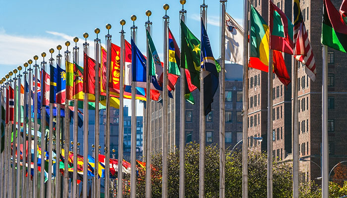
Still, the UN has faced tough times before – over many decades during the Cold War, the Security Council was crippled by deep tensions between the US and the Soviet Union. The UN is not as sidelined or divided today as it was then. However, as the relationship between China and the US sours, the achievements of global co-operation are being eroded.
The way in which people speak about the UN often implies a level of coherence and bureaucratic independence that the UN rarely possesses. A failure of the UN is normally better understood as a failure of international co-operation.
We see this recently in the UN’s inability to deal with crises from the ethnic cleansing of the Rohingya Muslims in Myanmar, to civil conflict in Syria, and the failure of the Security Council to adopt a COVID-19 resolution calling for ceasefires in conflict zones and a co-operative international response to the pandemic.
The UN administration is not primarily to blame for these failures; rather, the problem is the great powers – in the case of COVID-19, China and the US – refusing to co-operate.
Where states fail to agree, the UN is powerless to act.
Marking the 75th anniversary of the official formation of the UN, when 50 founding nations signed the UN Charter on June 26, 1945, we look at some of its key triumphs and resounding failures.
Five successes
1. Peacekeeping
The United Nations was created with the goal of being a collective security organisation. The UN Charter establishes that the use of force is only lawful either in self-defence or if authorised by the UN Security Council. The Security Council’s five permanent members, being China, US, UK, Russia and France, can veto any such resolution.
The UN’s consistent role in seeking to manage conflict is one of its greatest successes.
A key component of this role is peacekeeping. The UN under its second secretary-general, the Swedish statesman Dag Hammarskjöld – who was posthumously awarded the Nobel Peace prize after he died in a suspicious plane crash – created the concept of peacekeeping. Hammarskjöld was responding to the 1956 Suez Crisis, in which the US opposed the invasion of Egypt by its allies Israel, France and the UK.
UN peacekeeping missions involve the use of impartial and armed UN forces, drawn from member states, to stabilise fragile situations. “The essence of peacekeeping is the use of soldiers as a catalyst for peace rather than as the instruments of war,” said then UN Secretary-General Javier Pérez de Cuéllar, when the forces won the 1988 Nobel Peace Prize following missions in conflict zones in the Middle East, Africa, Asia, Central America and Europe.
However, peacekeeping also counts among the UN’s major failures.
2. Law of the Sea
Negotiated between 1973 and 1982, the UN Convention on the Law of the Sea (UNCLOS) set up the current international law of the seas. It defines states’ rights and creates concepts such as exclusive economic zones, as well as procedures for the settling of disputes, new arrangements for governing deep sea bed mining, and importantly, new provisions for the protection of marine resources and ocean conservation.
Mostly, countries have abided by the convention. There are various disputes that China has over the East and South China Seas which present a conflict between power and law, in that although UNCLOS creates mechanisms for resolving disputes, a powerful state isn’t necessarily going to submit to those mechanisms.
Secondly, on the conservation front, although UNCLOS is a huge step forward, it has failed to adequately protect oceans that are outside any state’s control. Ocean ecosystems have been dramatically transformed through overfishing. This is an ecological catastrophe that UNCLOS has slowed, but failed to address comprehensively.
3. Decolonisation
The idea of racial equality and of a people’s right to self-determination was discussed in the wake of World War I and rejected. After World War II, however, those principles were endorsed within the UN system, and the Trusteeship Council, which monitored the process of decolonisation, was one of the initial bodies of the UN.
Although many national independence movements only won liberation through bloody conflicts, the UN has overseen a process of decolonisation that has transformed international politics. In 1945, around one third of the world’s population lived under colonial rule. Today, there are less than 2 million people living in colonies.
When it comes to the world’s First Nations, however, the UN generally has done little to address their concerns, aside from the non-binding UN Declaration on the Rights of Indigenous Peoples of 2007.
4. Human rights
The Human Rights Declaration of 1948 for the first time set out fundamental human rights to be universally protected, recognising that the “inherent dignity and of the equal and inalienable rights of all members of the human family is the foundation of freedom, justice and peace in the world”.
Since 1948, 10 human rights treaties have been adopted – including conventions on the rights of children and migrant workers, and against torture and discrimination based on gender and race – each monitored by its own committee of independent experts.
The language of human rights has created a new framework for thinking about the relationship between the individual, the state and the international system. Although some people would prefer that political movements focus on ‘liberation’ rather than ‘rights’, the idea of human rights has made the individual person a focus of national and international attention.
5. Free trade
Depending on your politics, you might view the World Trade Organisation as a huge success, or a huge failure.
The WTO creates a near-binding system of international trade law with a clear and efficient dispute resolution process.
The majority Australian consensus is that the WTO is a success because it has been good for Australian famers especially, through its winding back of subsidies and tariffs.
However, the WTO enabled an era of globalisation which is now politically controversial.
Recently, the US has sought to disrupt the system. In addition to the trade war with China, the Trump Administration has also refused to appoint tribunal members to the WTO’s Appellate Body, so it has crippled the dispute resolution process. Of course, the Trump Administration is not the first to take issue with China’s trade strategies, which include subsidises for ‘State Owned Enterprises’ and demands that foreign firms transfer intellectual property in exchange for market access.
The existence of the UN has created a forum where nations can discuss new problems, and climate change is one of them. The Intergovernmental Panel on Climate Change (IPCC) was set up in 1988 to assess climate science and provide policymakers with assessments and options. In 1992, the UN Framework Convention on Climate Change created a permanent forum for negotiations.
However, despite an international scientific body in the IPCC, and 165 signatory nations to the climate treaty, global greenhouse gas emissions have continued to increase.
Under the Paris Agreement, even if every country meets its greenhouse gas emission targets we are still on track for ‘dangerous warming’. Yet, no major country is even on track to meet its targets; while emissions will probably decline this year as a result of COVID-19, atmospheric concentrations of greenhouse gases will still increase.
This illustrates a core conundrum of the UN in that it opens the possibility of global cooperation, but is unable to constrain states from pursuing their narrowly conceived self-interests. Deep co-operation remains challenging.
Five failures of the UN
1. Peacekeeping
During the Bosnian War, Dutch peacekeeping forces stationed in the town of Srebrenica, declared a ‘safe area’ by the UN in 1993, failed in 1995 to stop the massacre of more than 8000 Muslim men and boys by Bosnian Serb forces. This is one of the most widely discussed examples of the failures of international peacekeeping operations.
On the massacre’s 10th anniversary, then UN Secretary General Kofi Annan wrote that the UN had “made serious errors of judgement, rooted in a philosophy of impartiality”, contributing to a mass murder that would “haunt our history forever”.
If you look at some of the other infamous failures of peacekeeping missions – in places such as Rwanda, Somalia and Angola – it is the limited powers given to peacekeeping operations that have resulted in those failures.
2. The invasion of Iraq
The invasion of Iraq by the US in 2003, which was unlawful and without Security Council authorisation, reflects the fact that the UN is has very limited capacity to constrain the actions of great powers.
The Security Council designers created the veto power so that any of the five permanent members could reject a Council resolution, so in that way it is programmed to fail when a great power really wants to do something that the international community generally condemns.
In the case of the Iraq invasion, the US didn’t veto a resolution, but rather sought authorisation that it did not get. The UN, if you go by the idea of collective security, should have responded by defending Iraq against this unlawful use of force.
The invasion proved a humanitarian disaster with the loss of more than 400,000 lives, and many believe that it led to the emergence of the terrorist Islamic State.
3. Refugee crises
The UN brokered the 1951 Refugee Convention to address the plight of people displaced in Europe due to World War II; years later, the 1967 Protocol removed time and geographical restrictions so that the Convention can now apply universally (although many countries in Asia have refused to sign it, owing in part to its Eurocentric origins).
Despite these treaties, and the work of the UN High Commission for Refugees, there is somewhere between 30 and 40 million refugees, many of them, such as many Palestinians, living for decades outside their homelands. This is in addition to more than 40 million people displaced within their own countries.
While for a long time refugee numbers were reducing, in recent years, particularly driven by the Syrian conflict, there have been increases in the number of people being displaced.
During the COVID-19 crisis, boatloads of Rohingya refugees were turned away by port after port. This tragedy has echoes of pre-World War II when ships of Jewish refugees fleeing Nazi Germany were refused entry by multiple countries.
And as a catastrophe of a different kind looms, there is no international framework in place for responding to people who will be displaced by rising seas and other effects of climate change.
4. Conflicts without end
Across the world, there is a shopping list of unresolved civil conflicts and disputed territories.
Palestine and Kashmir are two of the longest-running failures of the UN to resolve disputed lands. More recent, ongoing conflicts include the civil wars in Syria and Yemen.
The common denominator of unresolved conflicts is either division among the great powers, or a lack of international interest due to the geopolitical stakes not being sufficiently high. For instance, the inaction during the Rwandan civil war in the 1990s was not due to a division among great powers, but rather a lack of political will to engage.
In Syria, by contrast, Russia and the US have opposing interests and back opposing sides: Russia backs the government of the Syrian dictator Bashar al-Assad, whereas the US does not.
5. Acting like it’s 1945
The UN is increasingly out of step with the reality of geopolitics today.
The permanent members of the Security Council reflect the division of power internationally at the end of World War II. The continuing exclusion of Germany, Japan, and rising powers such as India and Indonesia, reflects the failure to reflect the changing balance of power.
Also, bodies such as the IMF and the World Bank, which are part of the UN system, continue to be dominated by the West. In response, China has created potential rival institutions such as the Asian Infrastructure Investment Bank.
Western domination of UN institutions undermines their credibility. However, a more fundamental problem is that institutions designed in 1945 are a poor fit with the systemic global challenges – of which climate change is foremost – that we face today.